Quickly deploy QR codes to link from real-world to web.

QR codes are two-dimensional bar codes. They’ve become popular recently as a way to link to web sites from real-world items like product packaging, magazine ads and “home for sale” signs. Scan a QR with your phone and you can instantly be linked to a web site. QR codes can store lots of other kinds of text info, too.

Several years ago at SXSW, I met Dustin Haisler, who at the time was CIO for the town of Manor, Texas. Dustin used QR codes to mark items around town to link visitors to additional information online. He had great success at opening up the actions of the local government without spending a lot of money.

Since meeting Dustin, I’ve had ideas rattling around in my head about doing something cool with QR codes. At last month’s CityCamp Raleigh, ideas and inspiration clicked together and it occurred to me that it’d be interesting to use QR codes as temporary advertisements/info markers. Short term, I’ve got two ideas I’m experimenting with:

  1. Helping a group called Five Points CSA, a community-supported agriculture (CSA) group based in the Five Points area of Raleigh. There was a group at CityCamp Raleigh that helped organized a social media plan for the CSA.
  2. Helping get the word out about citizen advisory council (CAC) meetings. CACs are Raleigh’s link between communities and our government.

The Basic Idea
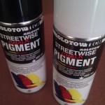
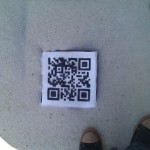
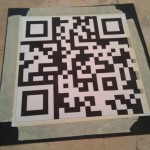
The idea I came up with was to build a rig to allow me to quickly tag QR codes on walls or sidewalks. I did some research and found that someone did something along these lines at TED, but I couldn’t find any instructions or guidelines for creating tools. I ended up making a rig that can be used to spray QR codes on a flat surface. I use spray chalk to make the codes temporary. My prototype creates a QR that links to the Five Points CSA Facebook page. I used a URL redirect on the CityCamp Raleigh server so that I could point the link somewhere else if needed (say a Flickr group or another web page). Then I shortened the URL via bit.ly. I shortened it for two reasons: 1) bit.ly records usage statistics 2) shorter URLs make simpler QR codes.

Building the Rig
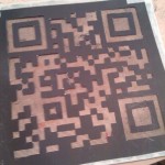
My QR rig is built from card stock. Card stock is relatively durable and easy to cut with an exacto knife. I’m working with someone to create a vinyl version that should be a bit more durable and allow me to spray the template clean. The magic sauce, I’ve found, is fiberglass screen. It’s just like the screen on the windows of your home. You can buy a roll of it from your local builder-supply shop for about five bucks. The screen gives you a base that you can attach the card stock to. This is important because it’s likely that your QR will have bits that aren’t attached to the main shape once you’ve cut them out.

I reversed the image of the QR before I cut it out. This is optional, but since I was cutting the image from black card stock, this just seemed to make my brain hurt less. I’d recommend using white card stock, though. That way, after you do your exacto-work, you can put a piece of black paper behind the cutout and check to make sure that it scans with your phone.

Next Steps

I’m and Android user. Google Goggles on my Nexus One scans my spray-chalked codes really quickly. I still don’t have a good test of scanability on iPhones, since I don’t have access to one. I’ve emailed photos of the code and the photos scan on an iPhone, but I still need to do some more real-world testing. It looks like the camera on iPhone 3’s and earlier is pretty crummy. But in this case, the iPhone is my Internet Explorer, so I’ll keep working on increasing the scanability for iPhones.

Lessons Learned So Far

  • QR codes are pretty forgiving. There’s a lot of error correction built into the code. This makes it work fairly well for my needs, but flat pavement or concrete works best.
  • The white border around the code is significant. It’s part of the code. I use a cardboard cut-out to put down a white section before I spray the code.
  • When you’re spraying – even if it’s chalk – you look like you’re up to no good.
Concerning the Proposed Falls Whitewater Park

Last week, the Raleigh Parks and Rec advisory board, on which I serve, heard public comments on the proposed Falls Whitewater Park. The “for” group was well organized and had a lot of info to present. The “against” group is primarily made up of folks that either live near the site of the proposed park, or are “friends of the river” and are concerned about the impact of the park.

I felt like the “against” group didn’t really have a concise list of issues about which they were troubled. By nature of being a group of concerned citizens rather than an organization (like a paddle club), they  were a bit less focused in their comments. I don’t want to put words in their mouths, but I’m going to try to make that list for them and give some of my personal thoughts on each issue.

Note: I spend a lot of time outdoors with my family enjoying Raleigh’s parks and greenways and I’m looking forward to the completion of the Neuse River Greenway, but I’m not a paddler.

  • Impact on natural beauty of area
    My  understanding is that the proposed updates will look pretty natural. Locally-quarried rock and river stones will be used. The park will be open dusk-to-dawn and will have no lighting. The Army Corps don’t plan to change the way they release water into the Neuse, so there won’t be higher water levels.
  • Too many people, too much noise
    I don’t really have an answer to this one. I don’t imagine that the people using the park will be more noisy than the people that currently paddle in the Falls Dam tail-race.
  • Worried about trash, littering
    My impression of paddlers is that they love their rivers. The paddling groups volunteer their time doing cleanup and restoration.
  • We should be spending the money elsewhere
    The Falls Whitewater steering group have announced that they plan to fully fund the park via grants and private contributions

My personal opinion is that we (Raleigh) should strive to offer outdoor recreation of as many types as possible. The 586-acre Forest Ridge Park that will soon be built nearby will offer ropes courses and outdoor adventure education. The under-construction Neuse River Greenway will offer walking and biking options. The nearest whitewater paddling options require a coupe hours of driving. By its nature, you can’t build a park of this kind just-anywhere. Putting a whitewater park here seems to make a lot of sense.

What are your thoughts?

Raleigh's Unified Development Ordinance

I make it a point to attend my CAC’s monthly meetings. Citizens Advisory Councils are the connecting point between Raleigh’s citizens and our local government. The meetings serve as a way for citizens to communicate with the government and as a way for the government to inform citizens. CACs are the only advisory boards to the city council that aren’t appointed. They’re completely independent, setting their own agendas and electing their own officers. A typical meeting of my CAC will involve presentations from the Raleigh Police Department on crime trends in the area, information from Parks and Recreation regarding local events and hearings concerning rezoning cases within our CAC.

At this month’s meeting, we had a change of pace. Members of the Department of City Planning organized a workshop to help us understand Raleigh’s new unified development ordinance (UDO) project. The UDO will replace the existing complicated and outdated zoning ordinances.

What is the UDO?

The basic idea of the UDO is that each parcel of land in Raleigh will have a code applied to it that will describe the type of use permitted (commercial, industrial, residential, etc.), the allowed height of buildings (in number stories) and the type of frontage the parcel will have. Frontage addresses how the building relates to the street and specifies the required distance from the street that buildings on the parcel must maintain as well as the character of the part of the building facing the street. In some cases frontage may even specify that there be a buffer of trees between the building and the street. The UDO puts a lot of emphasis on mixed-use properties.

Once the text of the UDO – the ordinance itself – is adopted, the process of translating the zoning of existing parcels into the new classification begins. This is tricky because city planners want to make sure that when they apply the new zones, they don’t conflict unnecessarily with what actually exists on the land. They also want to be careful not to ‘up-zone’ a property, which would increase the taxes paid by the land owner as well as open up the possibility of the owner using the land for undesired types of development. When there are questions about how to apply the new zone, planners often refer to the Future Land Use Map that’s part of the 2030 Comprehensive Plan. This map shows the type of use that Raleigh desires in an area in the future (for example, planning for an area to move more toward residential uses or toward commercial uses). The Comprehensive Plan is a long-term “vision” document intended to guide growth.

Rolling up our Sleeves

At our CAC meeting, we broke up into groups and tackled the translation of an area in our CAC from the old zoning rules to the UDO. Planners were available to answer our questions and give advice as we consulted the current use of the area and the future use maps to decide what UDO classifications we’d use. It wasn’t easy – we had a block of land that has a shopping center on it as well as a pocket of residential homes that have been been cut off into a “pocket” as new roads and development grew around them.

The exercise was very satisfying. We got some hands-on insight into the complicated issues that Raleigh planners face. I think it’s great that they made an effort to bring us into the process in such an interesting way.

Concerning the Honeycutt Creek Greenway

I’ve received several messages from Summerfield North residents via the comment form on this site (rather than via my email address available on the Raleigh web site), so I’m assuming I’m getting some traffic from internal neighborhood communications. I’m copy/pasting (with some paraphrasing) an email that I sent to one of your neighbors in hopes that it may answer some questions for those of you new to the discussion.

A bit of background about me: I’m a father of 2 children (5 and 8). We’re an active family and spend a lot of time outdoors at parks, hiking trails and riding bikes on the greenways. My son has learned to ride his bike on the greenway and we currently ride as a family as far as 15 miles piecing together the connections of some of the east-to-west greenway routes. I’ve started blogging about local parks as I visit them with my family – my blog is at http://gettoknowapark.org/. We live near your neighborhood and would likely use the parking at Honeycutt Creek park as our starting point for family rides.

Since you mention that you haven’t been to any of the meetings thus far, I want to make sure you’re aware of some things that may or may not have been mentioned in the communications you’ve received from your neighbors. As a worst-case scenario, routing the proposed greenway through your neighborhood would mean a wider sidewalk in some places. The mock-ups I’ve seen look pretty nice and the new sidewalks would be built within the easement that the city already owns along the side of city roads. The reason they make the sidewalks so wide is to make it safe for two bicycles to pass, or give a pedestrian a safe buffer from a passing bike.

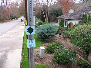
My understanding, though, is that one of the options that is being strongly considered wouldn’t affect the sidewalks at all. There would be small way-finding signs (~5 inch x 5 inch) that would be placed on existing traffic signs that would help people navigate the road sections between the traditional greenway that travels along the creek.

With respect to the issue of crossing Strickland, there are a couple of issues. The city is trying to locate the crossing in a place where there are already people crossing “unprotected”. It’s my understanding that kids from the school cross in this area already and that the city is trying to make that a bit safer. The other issue is that Strickland just has to be crossed at some place. The greenway advisory board took a field trip last week and saw how dangerous the current crossings at Six Forks and Falls of the Neuse are. Further, crossing at these intersections would then route the greenway along these busy roads that have lots of driveways and cross-streets. This isn’t a route I’d feel safe taking myself, and definitely not with my family.

So the issue becomes how best to cross a dangerous road. The plan that’s being proposed would put an island in the center of Strickland, so you’d only have to cross two lanes at a time. There would be cross-walks leading to the island and it would be located far-enough east on Strickland that the sight-line in either direction is maximized without making the crossing so far from the school that the kids wouldn’t use it.

Thanks for your email and your participation in the process.

Some further responses… I think the questions I’m responding to are apparent based on my wording, but feel free to ask questions in the comments.

One of the reasons I’m in such strong support of this greenway is that there are very few safe north-south corridors in North Raleigh and none that cross 540. I’m not sure if you’re aware, but the goal of the routing in your area is to cross under 540 at the tunnel that was built when the highway was established. The tunnel is located about 1/2 way between the Six Forks and Falls exits on 540.

In looking for the safest route for our area, there’s no option that can be 100% traditional greenway. The city typically buys land along creeks and sewer lines to use as greenway. Strickland Rd. is a ridge – water flows away from it both north and south – so there was never land purchased that connects the two nearby creek-system-based areas. I agree that riding through the neighborhood isn’t perfect, but I believe it to be the safest option. There are several other places in Raleigh where the greenway crosses through neighborhoods in a similar manner. The aim, of course, is to minimize these areas and get people on to the traditional trail.

With respect to crossing Strickland, I’ve actually felt pretty safe crossing South Wilmington Street where a greenway crosses south of downtown. It’s a wider and busier road, so they *have* added a stop light at the pedestrian crossing.

I’m not sure where the info comes from about pedestrians crossing Strickland, but I’ve heard it addressed at several PRGAB meetings and it was mentioned to us when the board spent last Saturday touring the key areas affected by the greenway plan.

Needed: Greenway Champion

Update: Please read this page before emailing me about this article.

Are you a big fan of Raleigh’s awesome greenway system? Great – I need your help.

At the November 19th meeting of the Parks and Recreation Greenway Advisory Board (PRGAB), a section of greenway in North Raleigh will be discussed. This section (the Honeycutt Creek Greenway) will eventually connect from Falls Lake to Shelley Lake. Read a bit about it on my Get To Know A Park blog. It’s going to be a great addition to the greenway system. The problem is that there’s a small but vocal group that’s raising a lot of fuss about the greenway passing through their neighborhood. Their arguments are along the lines of “putting this greenway through my neighborhood will lower my property value and bring in a lot of creepy people that I don’t want peeing in my front yard.”

Here’s where you can help: I need a couple of well-spoken greenway advocates to appear at the PRGAB meeting and speak out in favor of greenways in general and this stretch in the specific. This is an emotional group – you’ll need to be level headed and armed with facts.

Some things that might be helpful to know:

  • Greenways do not increase the crime rate in an area
  • Greenways don’t lower property values (they often increase it)
  • In Raleigh, Greenways aren’t paid for at the cost of education or jobs – they’re funded from an entirely separate source (bonds that we voted in support of in 2003 and 2007)

(check out my blog post for some supporting documentation.)

The perfect candidate for this assignment:

  • is an active user of the greenways
  • has children/family members that use the greenways
  • can maintain their sanity despite any level of crazy thrown at them
  • is not a knife-wielding, yard-peeing, toy-stealing thug
  • ideally lives in North Raleigh (extra points if you live in near Strickland Road between Six Forks and Falls of the Neuse)

Know anyone that fits this description? I’m not looking to pack the house – I’m hoping to find a couple people that can stand up at the meeting and speak out in defense of this project. The meeting is going to be held at the Jaycee park module at 2401 Wade Avenue at 5:30pm on November 19th. If you can help out, please let me know. If not, please consider sharing this with your friends, family, cycling club, civic group etc.

Thanks for helping!

Fixing GMail Sync Issues on the Android Platform

GMail on my G1 recently stopped syncing. The little sync indicator does its spinny-thing, but I don’t get new email from the server. Searches for “G1 sync fail gmail” and similar combinations didn’t turn up any good prospects initially. I eventually found the simple solution on the Google mobile support foums. Hope this helps someone out there!

NIMBY? – Support Your Local Greenway

Update: Please read this page before emailing me about this article.

Over a decade ago, soon after I moved into my current home, I attended a homeowner’s association meeting where the new neighborhood swimming pool was a hotly-debated topic. A small, but vocal, minority actually suggested that the pool should be filled with concrete. The argument was basically “upkeep of the pool costs too much and I don’t plan to use it, so get rid of it”. Certainly, it’s easy to make a case for how a neighborhood pool increases your property value. Our pool has become a hub for activities throughout the year. Looking back on that meeting, I laugh at the NIMBY (Not In My Back Yard) attitude so strongly voiced by that minority.

Last night, I had the displeasure of witnessing a similar display of  fingers-in-my-ears-I-can’t-hear-you from citizens opposing routing of a greenway along the sidewalk across the front of their property in North Raleigh. Some things that I actually heard said:

  • “I don’t want the cyclists that ride on the greenway peeing in my front yard and using my water spigot!”
  • “It’s not going across your front yard, so shut up!” (directed to a neighbor that said they’d welcome a connector path that’d let them safely reach other parts of the city)
  • “If the greenway goes through our neighborhood, that means that the crime rate is going to up!”
  • “Great – now we’re going to have a bunch of homeless people living in our neighborhood!”
  • In response to the answer to a question about who will maintain the cleanliness of the trail (the City of Raleigh will): “I’ve driven past a pile of beer bottles [on a nearby road] for two weeks – the city hasn’t picked those up!” (When I asked her why she hadn’t, her reply was “…and get out of my car? On that street?”)

The group was really pretty rude. Some would hardly let their sympathetic on-the-same-side neighbors finish a sentence, let alone the city representatives that were present to hear their grievances (BTW, the Park & Rec representatives did an excellent job of maintaining level-headed-ness in spite of the verbal abuse). There was also a lot of reference to anecdotal “I knew someone who lived near a greenway and someone stole all of their kids toys” rhetoric, but not much fact.

Research has shown that having neighborhood access to a greenway increases property value and has no impact whatsoever on the crime rate or homeless rate in your area. None. The trails are often credited with deterring crime. The Rails-to-Trails conservancy put together a comprehensive and well-written pamphlet that summarizes the experiences of 372 communities with large trail networks.

I applaud the vision that Raleigh has for the future of our city. Since the mid-80’s, Raleigh has deliberately set aside land for green spaces and secured easements for routing of trails throughout the area. We have a great city Parks & Rec department that works with affected communities to find the best fit when routing trails through existing neighborhoods. And Raleigh’s citizens obviously value this mission as is evidenced by the passing of the bonds that fund these projects.

OK. I’ve got that off my chest. I’ve been pretty ticked since attending that neighborhood meeting. But here’s what I hope you take away with you today: there are a lot of great parks, green spaces and trails in our city. They benefit us all financially and from a quality-of-life point of view. Go outside today!

Oh, yeah – not sure where to start? Check out my blog about area parks and greenways.

Project : Recycled Bottle Tiki Torches

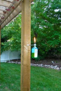
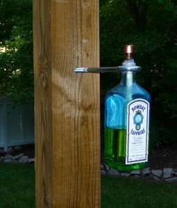
This weekend, I built a couple of tiki torches based on this article that I discovered via LifeHacker. I made mine from a couple of Bombay Sapphire bottles. I had trouble finding some of the hardware mentioned in the article, but the folks at my friendly Ace Hardware helped me experiment and find an excellent solution. I bought a couple of eye-bolts that had a diameter a little bigger than the neck of the bottle. I secured the bottles with lock-washers that were just the right size to mate with the threads on the Sapphire bottle. They were just wide enough to keep from passing through the eye bolt. Simple, easy and very minimal.

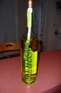
The yellow torch liquid looks great inside the blue Sapphire bottle. I also made an extra torch (to put on the table) from a bottle of Leblon Chacaça.

BTW – I love Ace Hardware. Every time I go there, the staff is just the right amount of helpful. When buying parts for this project, the AH employee spent at least 20 minutes with me, wandering the store, trying alternate ideas. They’re great.

Personalize Your Comments

If you’ve ever posted or read comments on a blog, you’ve probably noticed the little icons associated with each post. If you’re a new commenter, you may wonder why you get some sort of boring nondescript icon instead of something that reveals your True Character.

While some sites’ comment systems have their own proprietary way to manage commenter icons, many sites use Gravatar to display these. Gravatar (Globally Recognized Avatar) allows you to set up an icon that’s associated with your email address. That way, wherever you post a comment (if that site makes use of Gravatars), you’ll have the same icon next to your comment. Just make sure you set up your Gravatar with the email address you plan to use while posting (you can add additional email addresses to a single Gravatar account).

Gravatar is made by the folks responsible for the blogging/CMS platform WordPress. Here’s a video that explains how Gravatars work:

Protected: mix: after everything, this?

This content is password protected. To view it please enter your password below: